
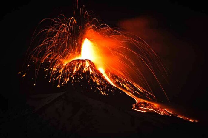
NASA released a NISAR time‑lapse that shows lava spreading from Russia’s Krasheninnikov volcano after centuries of quiet, turning raw radar data into a clear view of change on the ground.
Story Highlights
- NASA assembled 17 radar frames from the U.S.–India NISAR mission into a time‑lapse of the lava field.
- The eruption followed a powerful magnitude 8.8 offshore earthquake in July 2025 near Kamchatka.
- Volcano monitors in Russia tracked ongoing lava flows and kept aviation at a caution level.
- The release shows how space radar can map hazards even in remote, harsh regions.
NISAR’s Time-lapse Shows Lava Growth Over Months
NASA said the joint U.S.–India NISAR satellite captured repeated radar images of Krasheninnikov from December 2025 through mid‑August 2026. Scientists sequenced 17 frames into a time‑lapse that shows lava spreading from the volcano’s northern crater on the Kamchatka Peninsula. Radar sees through clouds, smoke, and darkness, so it can map surface changes when regular cameras cannot. The agency released the product on September 24, 2026, describing the evolving lava field in clear, simple terms.
NASA’s mission updates also highlighted the same changes in the lava field. The agency’s science page described how the lava branched out like vines from the northern crater and noted the regional setting on Russia’s Pacific coast. The post tied the time‑lapse to a broader push to use radar data for routine hazard mapping. That includes building tools that combine satellite passes so emergency teams and local scientists can track change faster and with more confidence.
Earthquake Jolt and a Long-Quiet Volcano
On July 30, 2025, a magnitude 8.8 earthquake struck offshore near Kamchatka. A few days later, Krasheninnikov erupted after a long period with little to no activity, according to NASA materials describing the sequence of events. Earlier radar work by NASA’s Jet Propulsion Laboratory measured ground shifts in southern Kamchatka after the quake, part of a standard approach to check for crustal movement near faults and volcanoes that can stress the surface and alter hazard outlooks.
Regional and global catalogs add independent backing that the volcano was active in 2026. The Kamchatkan Volcanic Eruption Response Team reported steady lava flows from the northern cone in late June and early July, with a daily thermal hotspot in satellite images. Russia’s aviation color code stayed at Yellow, which signals caution for aircraft, while ash that winds kicked up drifted tens of miles to the south‑southeast during mid‑July.
Why This Space Radar Matters for the Public
Volcanoes do not follow borders, and many sit far from roads or sensors. Space radar helps fill those gaps. Interferometric synthetic aperture radar, the method behind NISAR’s maps, measures tiny surface shifts over time. Past studies show it can reveal warning signs or track hazards when other tools cannot, especially in cloudy or dark conditions. The Krasheninnikov time‑lapse shows a practical win: a clear, repeat view of lava growth that supports scientists, pilots, and nearby communities.
People on the right and left often worry that big projects waste money or hide results. This case offers a counterpoint grounded in facts. A publicly funded, international mission produced open data that any researcher can check. It delivered a product that is easy to understand and tied to safety and science. That is the point of public service: provide clear, shared tools that help people face real‑world risks, not spin a narrative. The data and the time‑lapse stand on their own.
Sources:
nasa.gov, science.nasa.gov, gagadget.com